Climograph
There isn’t a climograph for the entire country of Egypt, as there are different areas and climates all throughout it’s regions.
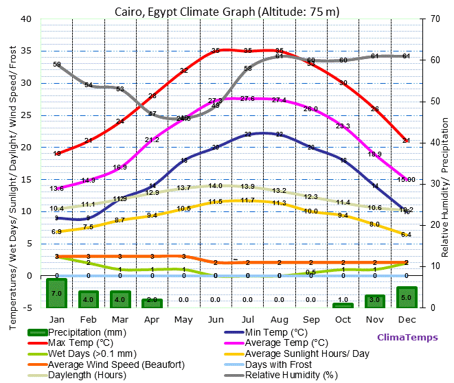
The majority of the country is taken up by dry deserts in which small numbers of people live, but the majority live around the delta of the Nile River itself, which stretches all the way through the eastern part of Egypt down to Lake Nasser. This climograph was chosen because it focuses on Cairo, which is one of the more highly populated places as well as a region that has the most diverse area for weather in Egypt. It is also the capital of Egypt.
One noticeable thing is when it comes to temperature there is a spike in the Summer, often resulting in drier conditions and less precipitation. Wind speed also dip, and then rise. It also seems like the wet seasons are the best during their winter season and how everything else on the map seems to dip down dramatically in the Winter season as well.
